


Adams 198, Adams County, Colorado
About
Outline

Summary
| Unique Area Identifier | 546367 |
| Name | Adams 198 |
| County | Adams County |
| State | Colorado |
| Area (square miles) | 4.70 |
| Land Area (square miles) | 4.69 |
| Water Area (square miles) | 0.01 |
| % of Land Area | 99.82 |
| % of Water Area | 0.18 |
| Latitude of the Internal Point | 39.75608560 |
| Longtitude of the Internal Point | -104.78400240 |
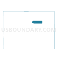
Maps


Graphs
Select a template below for downloading or customizing gragh for Adams 198, Adams County, Colorado


Neighbors
Neighoring Voting District (by Name) Neighboring Voting District on the Map
- Adams 195, Adams County, CO
- Adams 197, Adams County, CO
- Adams 199, Adams County, CO
- Arapahoe 501, Arapahoe County, CO
- Arapahoe 503, Arapahoe County, CO
- Arapahoe 505, Arapahoe County, CO
- Arapahoe 538, Arapahoe County, CO
- Denver 734, Denver County, CO
- Denver 735, Denver County, CO
- Denver 739, Denver County, CO
Top 10 Neighboring County Subdivision (by Population) Neighboring County Subdivision on the Map
- Denver CCD, Denver County, CO (600,158)
- South Aurora CCD, Arapahoe County, CO (360,758)
- North Aurora CCD, Adams County, CO (39,980)
- East Arapahoe CCD, Arapahoe County, CO (23,477)
Top 10 Neighboring Place (by Population) Neighboring Place on the Map
Top 10 Neighboring Unified School District (by Population) Neighboring Unified School District on the Map
Top 10 Neighboring State Legislative District Lower Chamber (by Population) Neighboring State Legislative District Lower Chamber on the Map
- State House District 7, CO (101,799)
- State House District 30, CO (82,192)
- State House District 36, CO (78,030)
- State House District 42, CO (69,324)
Top 10 Neighboring State Legislative District Upper Chamber (by Population) Neighboring State Legislative District Upper Chamber on the Map
- State Senate District 27, CO (188,185)
- State Senate District 25, CO (181,050)
- State Senate District 33, CO (160,926)
- State Senate District 29, CO (129,532)
Top 10 Neighboring 111th Congressional District (by Population) Neighboring 111th Congressional District on the Map
Top 10 Neighboring Census Tract (by Population) Neighboring Census Tract on the Map
- Census Tract 83.90, Denver County, CO (7,703)
- Census Tract 83.88, Denver County, CO (6,962)
- Census Tract 83.12, Denver County, CO (6,825)
- Census Tract 819, Arapahoe County, CO (6,332)
- Census Tract 83.53, Adams County, CO (6,044)
- Census Tract 83.08, Adams County, CO (5,557)
- Census Tract 818, Arapahoe County, CO (5,421)
- Census Tract 71.04, Arapahoe County, CO (4,958)
- Census Tract 83.09, Adams County, CO (3,254)
- Census Tract 71.05, Arapahoe County, CO (3,103)